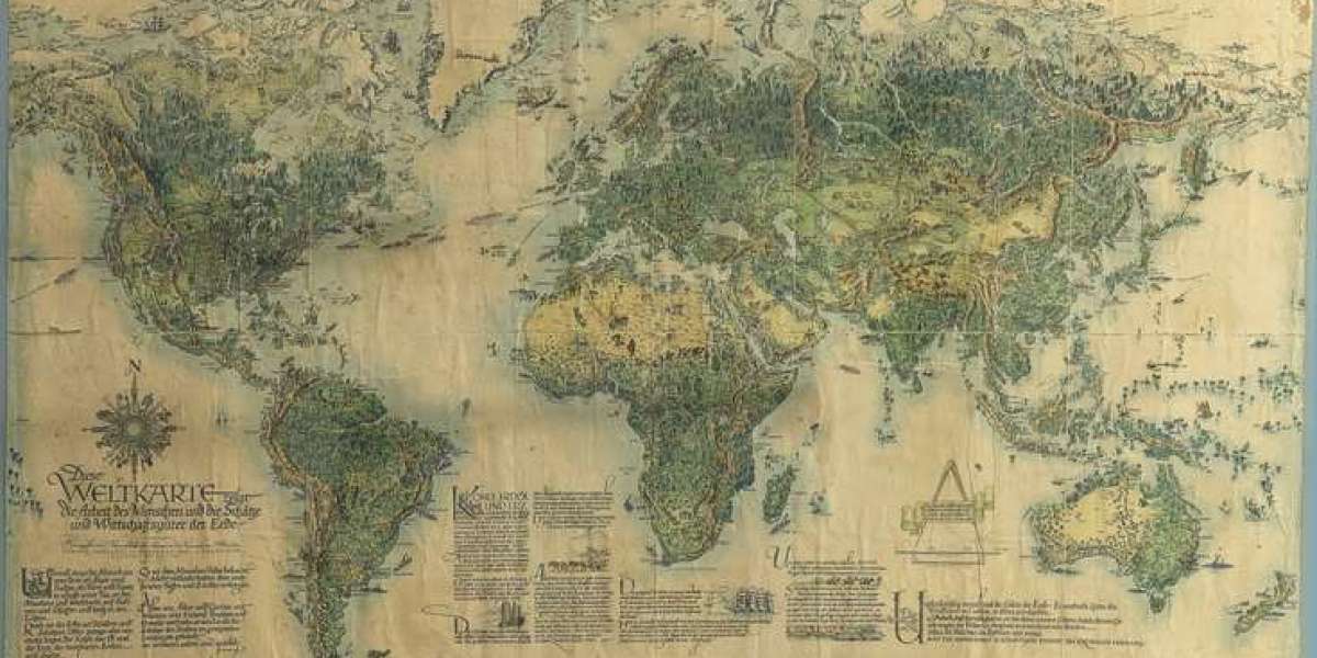
An antique map gallery is more than a collection of old maps displayed on walls or stored in cabinets. It is a place where geography, history, art, exploration, and human curiosity come together. Every map has a story to tell, from the way people once understood distant lands to the routes used by travelers, merchants, explorers, and sailors. For collectors and history enthusiasts, an antique map gallery offers a fascinating opportunity to explore the past through beautifully preserved cartographic works.
Antique maps can transform an ordinary room into a space filled with character and historical atmosphere. Their artistic details, decorative borders, unusual place names, and distinctive geographical designs make them appealing to people who appreciate both history and visual beauty. Whether you are an experienced collector or simply interested in historic maps, visiting an antique map gallery can open the door to a remarkable world of discovery.
What Makes an Antique Map Special?
An antique map represents much more than a geographical drawing. It reflects the knowledge, technology, culture, and imagination of the period in which it was created. Before modern satellite systems and digital mapping tools, cartographers relied on observations, travel reports, surveys, maritime information, and previously published maps to create representations of the world.
Because of this, historic maps often contain fascinating details that are not found on modern maps. Mountains may be illustrated with artistic shading, coastlines may feature decorative ships, and oceans can include sea creatures, compass designs, and elaborate lettering. Some maps also contain illustrations of important cities, regional landmarks, or historical figures.
An antique map gallery brings these details together so visitors can examine how our understanding of the world developed over time.
Exploring History Through Antique Maps
Maps provide an unusual way to study history because they show how people viewed places during a particular period. Borders, cities, roads, rivers, and geographical names changed over centuries, and antique maps preserve evidence of those changes.
A map created hundreds of years ago can reveal political boundaries that no longer exist. It may show an old name for a city, a forgotten kingdom, or a settlement that later became an important modern destination. Studying several maps of the same region can reveal how geography and society developed across generations.
For this reason, an antique map gallery can appeal to historians, researchers, students, travelers, and anyone interested in understanding the relationship between people and places.
The Artistic Appeal of Antique Maps
One of the most attractive features of antique maps is their artistic quality. Historic cartographers often treated mapmaking as both a scientific discipline and an artistic craft. A map could be designed with decorative lettering, elaborate illustrations, carefully drawn borders, and detailed geographical features.
Many antique maps have a warm and distinctive appearance created by age, paper texture, printing techniques, and careful preservation. Their visual character can make them suitable for display in homes, libraries, offices, studies, hotels, and other sophisticated spaces.
An antique map does not need to be understood only as a historical document. It can also be appreciated as a piece of artwork that brings depth and personality to an interior.
Antique World Maps and Global Discovery
Antique world maps are particularly fascinating because they demonstrate how people gradually developed a broader understanding of the planet. Different periods produced very different interpretations of continents, oceans, islands, and distant territories.
Older world maps may contain geographical features that appear unfamiliar today. Some regions may be incomplete, while others may be represented according to limited information available at the time. These differences make historic world maps valuable for understanding the history of exploration and geographical knowledge.
An antique map gallery featuring world maps can provide visitors with a visual journey through centuries of global discovery. Comparing maps from different periods can reveal how coastlines became more accurate, new territories were recorded, and geographical knowledge expanded.
Regional Maps With Local Stories
While world maps attract considerable attention, regional and local maps can be equally interesting. A map of a particular country, county, city, coastline, or historic territory may provide details that cannot be seen on a broader world map.
Local maps can show former roads, settlements, estates, waterways, and boundaries. For collectors with a personal connection to a particular location, these maps can have special significance. A historic map of a hometown, ancestral region, or favorite destination can combine geographical interest with a strong sense of personal history.
An antique map gallery can therefore appeal to both international collectors and people looking for something closely connected to a specific place.
The Importance of Map Condition
Condition is an important consideration when examining an antique map. Historic maps have often survived for many decades or centuries, so their physical condition can vary considerably.
Collectors generally pay attention to the quality of the paper, clarity of the printed details, completeness of the map, signs of restoration, and overall presentation. A well-preserved map can be especially attractive because its original details remain easy to appreciate.
Proper care and professional preservation can help protect antique maps for future generations. Because historic paper can be delicate, appropriate storage, framing, and handling are important parts of responsible collecting.
How an Antique Map Gallery Supports Collectors
Collectors often visit antique map galleries because they provide an opportunity to examine maps closely and learn more about their origins. A knowledgeable gallery can help visitors understand the period, cartographer, geographical subject, printing style, and historical importance of a particular map.
Collecting antique maps can become a rewarding long-term interest. Some people begin with a single map connected to a favorite destination and gradually develop a broader collection. Others focus on a particular cartographer, historical period, country, city, or geographical theme.
The most rewarding collections often reflect the personality and interests of the collector rather than simply focusing on quantity.
Choosing an Antique Map for Your Collection
Selecting an antique map should begin with genuine interest. A map connected to a place, period, or subject that you personally appreciate can remain meaningful for many years.
Some collectors are attracted to maps because of their historical significance, while others prefer decorative examples with impressive artwork. There are also collectors who focus on geographical rarity, unusual regional names, historic boundaries, or specific cartographic styles.
When exploring an antique map gallery, take time to examine the map carefully. Look at its lettering, decorative elements, geographical details, publication information, and overall presentation. Understanding why a map interests you can make the collecting experience more enjoyable.
Antique Maps as Interior Décor
Historic maps can create a distinctive visual statement when displayed properly. Their classic appearance works especially well in studies, libraries, reading rooms, offices, living spaces, and traditional interiors.
A large antique world map can become the central feature of a room, while smaller regional maps can create a more subtle historical theme. Framing also plays an important role because the frame can complement both the map and the surrounding décor.
For people searching for meaningful wall décor, antique maps offer an alternative to ordinary artwork. They combine visual appeal with historical information, giving visitors something interesting to examine and discuss.
The Educational Value of Historic Maps
Antique maps can also serve as educational resources. Teachers, students, researchers, and history enthusiasts can use them to explore how geographical knowledge changed throughout different periods.
Looking at an old map encourages people to ask questions. Why was a particular city placed in that location? Why does a region have a different name? Why are certain boundaries different from those found today? What information did the cartographer use when creating the map?
These questions turn a map into the beginning of a larger historical investigation. An antique map gallery can therefore encourage learning through visual exploration rather than relying entirely on written historical accounts.
Understanding Cartographers and Their Craft
Behind every historic map is the work of a cartographer or publishing house. The quality of a map often reflects the skills, knowledge, and resources available during its period.
Cartographers had to organize geographical information into a form that could be understood by readers. They made decisions about scale, lettering, symbols, boundaries, and decorative presentation. Their work required patience and attention to detail.
Learning about famous cartographers can add another dimension to collecting. A map becomes more meaningful when you understand who created it, when it was produced, and what geographical knowledge influenced its design.
Why Antique Maps Remain Popular Today
Modern technology has made maps easier to access than ever before, yet antique maps continue to attract collectors and enthusiasts. Their appeal comes partly from their physical presence. A historic map is a tangible object connected to another period of history.
Digital maps can provide instant information, but an antique map offers something different. It allows people to see how earlier generations understood the world. The imperfections, artistic details, historic names, and aged appearance create an experience that modern mapping technology cannot reproduce.
This combination of history and art helps explain why antique maps continue to have a special place among collectors and interior design enthusiasts.
Visiting an Antique Map Gallery
Visiting an antique map gallery can be an inspiring experience even if you have never collected maps before. Take time to explore different geographical regions and historical periods. Notice how the appearance of maps changes from one era to another.
You may discover that a map catches your attention because of its artwork, while another becomes interesting because of its historical story. The experience is highly personal, and there is no single type of map that appeals to everyone.
A good antique map gallery can also provide valuable background information, helping visitors understand what they are seeing and why particular maps are important.
Preserving Maps for Future Generations
Preservation is an important part of the antique map world. Historic maps are pieces of cultural and geographical history, and careful treatment helps ensure that they remain available for future generations.
Collectors should consider suitable framing, appropriate storage, controlled surroundings, and careful handling. Professional advice can be valuable when dealing with particularly old or delicate maps.
Preserving an antique map is not simply about protecting an attractive object. It is about maintaining a physical connection to the people, places, and ideas represented on the map.
Building a Meaningful Antique Map Collection
A meaningful collection does not have to contain hundreds of maps. Even a small selection can become fascinating when each piece has a clear reason for being included.
Some collectors create collections around a specific country or city. Others focus on maps from a particular century or cartographic tradition. A collector may also choose maps connected to exploration, transportation, architecture, historical boundaries, or personal travel experiences.
Over time, the collection can become a visual record of the collector's interests. Each new map adds another chapter to that story.
The Lasting Charm of an Antique Map Gallery
An antique map gallery provides a unique meeting place between history and art. Every map represents a moment when people were trying to understand their surroundings and record the world as they knew it.
From beautifully illustrated world maps to detailed regional charts, antique maps offer endless opportunities for discovery. They can educate, decorate, inspire, and encourage a deeper appreciation for the history of places.
For collectors, an antique map gallery can be the starting point for a rewarding journey. For interior enthusiasts, it can provide distinctive and meaningful décor. For historians and researchers, it offers valuable visual evidence of changing geographical knowledge.
Most importantly, antique maps remind us that the world has always been a subject of curiosity. Long before modern technology made geographical information instantly available, people carefully documented what they knew, explored what they did not, and created maps that continue to fascinate us today. An antique map gallery preserves that spirit of discovery, allowing each generation to look back at the world through the eyes of those who mapped it before us.